
Trails & Activities
FCMP/ERA-graded hiking routes and adventure in the wild
Official grading system
How the trails are graded
Walking routes in Peneda-Gerês National Park follow the official grading of the FCMP — Portuguese Camping and Mountaineering Federation, in line with the standards of the ERA — European Ramblers' Association. Every route is approved, waymarked on the ground and registered with a unique code.
Route types FCMP / ERA grading
PR — Short Route
Routes of up to 30 km, usually walked in a single day.
Yellow / white waymarks.
GR — Long-Distance Route
Multi-day routes of more than 30 km that link regions.
Yellow / red waymarks.
AL — Local Route
Local routes, usually short and interpretive.
Green / white waymarks.
Difficulty grades 4 official FCMP levels
Easy
Level 1
Flat terrain or gentle slopes. Well-marked paths. No experience needed. Suitable for all ages and fitness levels.
Flat terrain or gentle slopes. Well-marked paths. No experience needed. Suitable for all ages and fitness levels.
Moderate
Level 2
Uneven terrain with moderate climbs and descents. Requires good fitness and hiking boots. Some experience recommended.
Uneven terrain with moderate climbs and descents. Requires good fitness and hiking boots. Some experience recommended.
Hard
Level 3
Demanding terrain with steep gradients. Requires good physical preparation, proper gear and experience of mountain hiking.
Demanding terrain with steep gradients. Requires good physical preparation, proper gear and experience of mountain hiking.
Very Hard
Level 4
High mountain terrain in severe conditions. Only for experienced hikers with technical gear and, ideally, a certified guide.
High mountain terrain in severe conditions. Only for experienced hikers with technical gear and, ideally, a certified guide.
Standard information for each route
- Distance in km (total)
- Total elevation gain/loss
- Estimated time at a moderate pace
- Route type — loop, linear or mixed
- Starting point with GPS coordinates
- Accessibility for reduced mobility
- Dogs allowed (always on a lead)
- Best season and restrictions
6
Featured routes
4
Difficulty levels
~600 km
GR50 Long-Distance Route
112
Emergency
FCMP-approved routes
Trails in the National Park
Filter by difficulty to find the right route for your level and goals. Always check the route's status before you set off.
Difficulty:
PR2 GER● Easy Open
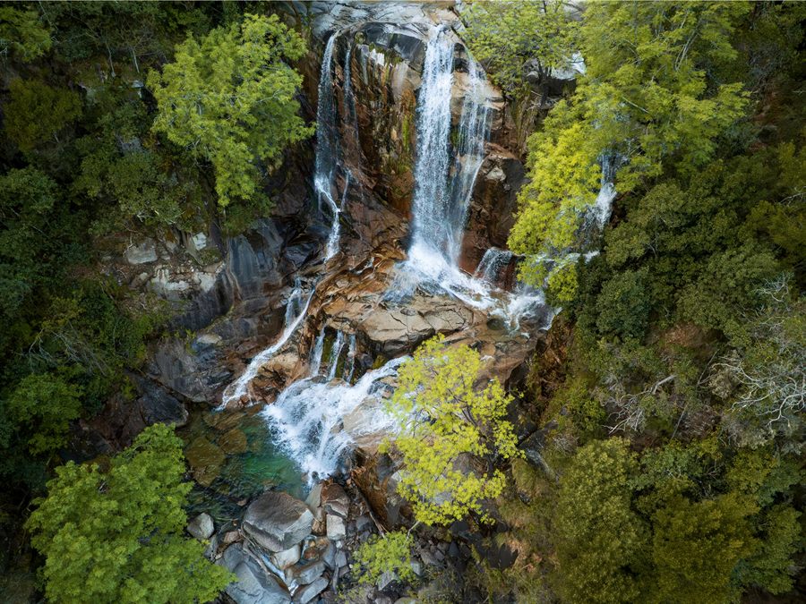
Cascata do Arado Trail
The park's most popular trail. It follows the Arado stream to the impressive Cascata do Arado, one of the largest and most photogenic waterfalls in the park. Ideal for families and first-time visitors.
8.2 km +280 m 2h30–3h Loop Ermida Dogs allowed Partial (500 m) All year
Last updated: 01/05/2025
See full details
Points of interest
- Cascata do Arado (~8 m drop)
- Arado stream with natural pools
- Pedunculate oak forest
- Ermida village (starting point)
Practical information
- Start GPS: 41°44'N, 8°11'W
- Free parking in Ermida
- Little shade in some sections in summer
- Bring 1.5 L of water per person
Season and conditions
- Best time: April–June and September–October
- Natural pools: June–September
- May be closed during high wildfire risk
Waymarking
- PR waymarks: yellow/white
- Well-marked and well-used path
- Signboard at the start of the route
PR5 GER● Easy Open
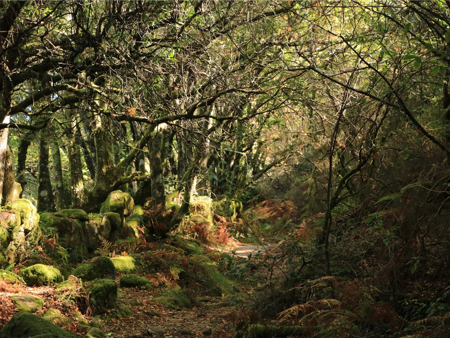
Mata da Albergaria Trail
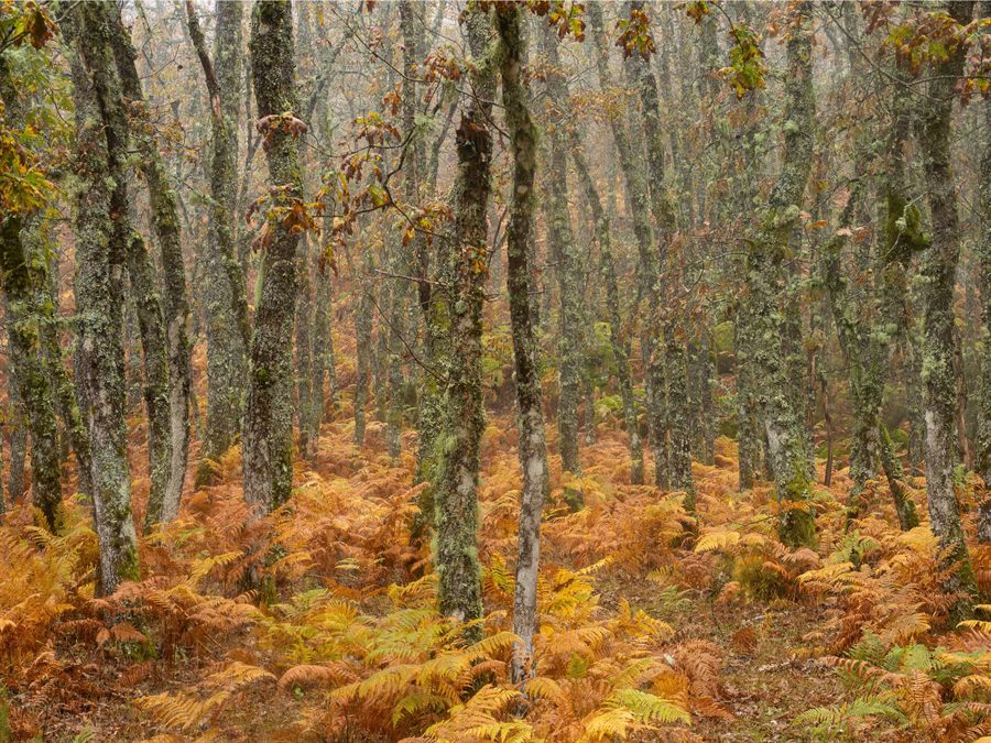
An interpretive walk through the Mata da Albergaria, one of the finest Quercus robur oak woods in the Iberian Peninsula. Ideal for wildlife watching and relaxed family walks.
5.4 km +120 m 1h30–2h Loop Albergaria Dogs allowed Partly accessible All year
Last updated: 01/05/2025
See full details
Points of interest
- Quercus robur oak wood with centuries-old trees
- Rio Homem — crossing on a stone bridge
- Roe deer sightings at dawn
- Interpretive panels along the route
Practical information
- Start GPS: 41°42'N, 8°09'W
- Parking at the Caldas Visitor Centre
- Flat to gently rolling terrain
- Excellent for nature photography
Season and conditions
- Open all year
- Best at dawn for wildlife watching
Waymarking
- PR waymarks: yellow/white
- Well-signed interpretive route
PR1 GER● Moderate Restricted
Section between km 9 and km 11 with damaged signage. Check with the Visitor Centre before setting off.
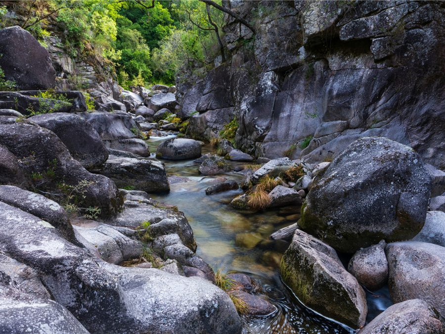
Rio Homem Trail
One of the park's most complete routes, following the Rio Homem for much of the way. It combines forest, riverside scenery, stone bridges and viewpoints over the valley.
14.3 km +520 m 4h–5h Linear Campo do Gerês Dogs allowed Apr–Oct
Last updated: 20/04/2025
See full details
Points of interest
- Vilarinho das Furnas dam
- Submerged village visible in the dry season
- Rio Homem natural pools
- Homem Valley viewpoint
- Roman bridges
Practical information
- Start GPS: 41°43'N, 8°10'W
- Linear route — return transport needed
- Waterproof footwear recommended (river crossings)
- Bring 2 L of water + a snack
Season and conditions
- Best time: April–June and September–October
- Submerged village visible: August–September (low water)
- Avoid during high wildfire risk
Waymarking
- PR waymarks: yellow/white
- Some sections with sparse signage
- Download the GPX beforehand
PR3 GER● Moderate Open
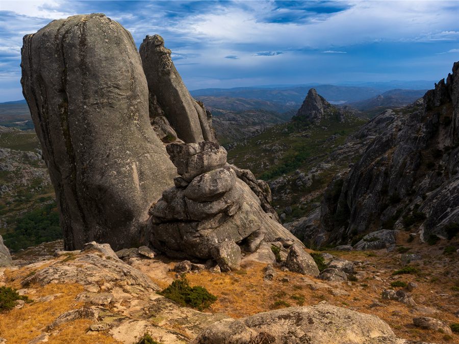
Pedras Borrachas Trail
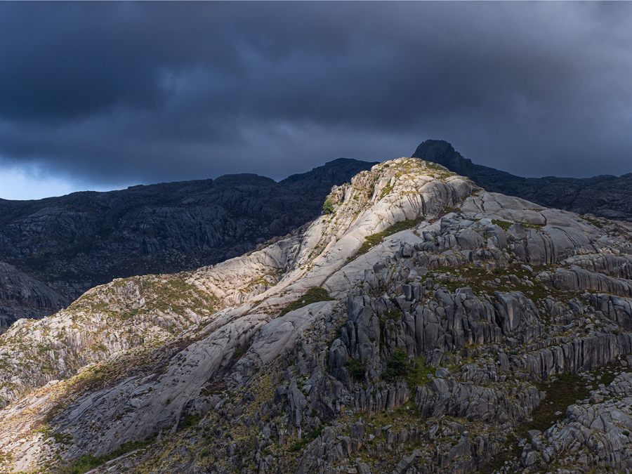
A route through unique granite formations — the "Pedras Borrachas" — with stunning views over the Serra do Gerês. One of the most photographed trails in the park.
11.0 km +640 m 3h30–4h30 Loop Caldas do Gerês Dogs allowed Apr–Nov
Last updated: 01/05/2025
See full details
Points of interest
- The Pedras Borrachas granite formations
- 360° panorama over the Gerês valley
- Garrano horse sighting area
- Heathland and upland meadows
Practical information
- Start GPS: 41°44'N, 8°09'W
- Exposed area — avoid during thunderstorms
- Sun protection essential in summer
- Bring 2 L of water (no springs on the route)
Season and conditions
- Best time: May–October
- Snow possible on high ground until March
Waymarking
- PR waymarks: yellow/white
- Well marked across the granite sections
PR4 GER● Hard Closed (out of season)
Closed from November to April due to snow and ice on the high ground.
Roman Geira Trail
A historic route along Roman Road XVIII (the Geira), the 1st-century AD road that linked Braga to Astorga. It still has original Roman milestones and stretches of paving in excellent condition.
18.5 km +890 m 5h30–7h Linear Portela do Homem Dogs allowed May–Oct
Last updated: 01/05/2025
See full details
Points of interest
- Original Roman paving (1st century AD)
- Roman milestones in situ
- Portela do Homem — Portugal/Spain border
- Views of the Xurés Natural Park
- Historic transhumance area
Practical information
- Start GPS: 41°48'N, 8°12'W
- Linear route — arrange return transport
- Snow possible in places until April
- Waterproof hiking boots essential
- Bring 2.5 L of water + lunch
Season and conditions
- Open May–October
- Snow and ice possible until April
- Always check conditions before setting off
Waymarking
- PR waymarks: yellow/white
- Roman paving visible in several sections
- Numbered milestones along the route
GR50● Very Hard Open
Peneda-Gerês Long-Distance Route
The park's long-distance route crosses all four sectors — Peneda, Soajo, Amarela and Gerês — in an epic traverse that is a benchmark for Iberian hiking.
~600 km (total) +6,800 m (per sector) 6–12 days Linear / loops by sector Several entry points Dogs allowed May–Oct
Last updated: 01/05/2025
See full details
Points of interest
- Peneda sector — Serra da Peneda and Castro Laboreiro
- Soajo sector — granaries and Soajo village
- Amarela sector — Serra Amarela and Lindoso
- Gerês sector — Caldas, Rio Homem and the border
Practical information
- Accommodation: rural houses and campsites along the route
- Water available in the villages
- FCMP-certified guide recommended
- IGeoE 1:25,000 maps essential
Season and conditions
- Open May–October
- Snow and ice at altitude until April
- Some sections may be restricted — check with ICNF
Waymarking
- GR waymarks: yellow/red
- Continuous waymarking along the whole route
Nature & Adventure
Other activities in the Park
Beyond the trails, Peneda-Gerês National Park offers a wide range of nature and adventure activities — all subject to specific ICNF regulations and available with certified operators.
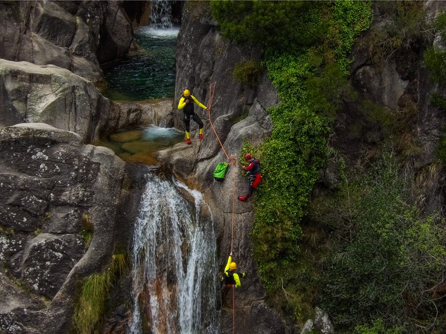
Canyoning & Waterfalls
Descend canyons and waterfalls with abseiling, jumps and swimming in mountain rivers. Requires an ICNF-certified operator. Beginner to advanced levels available.
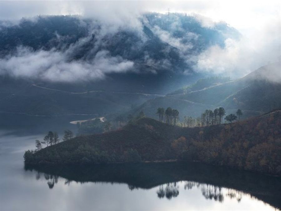
Canoeing & Kayaking
The Caniçada and Vilarinho das Furnas reservoirs offer excellent conditions for canoeing and kayaking. Hire available from local operators.
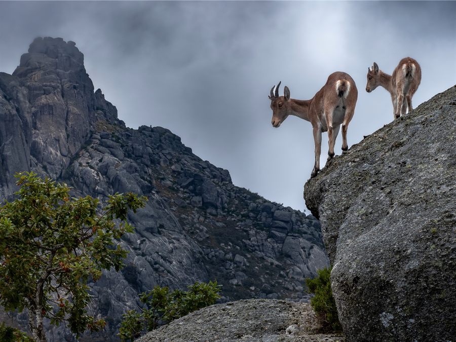
Wildlife Watching
Look out for roe deer, garrano horses, the Iberian wolf (rare), golden eagles and eagle owls. Dawn outings with a naturalist guide give you the best chance.
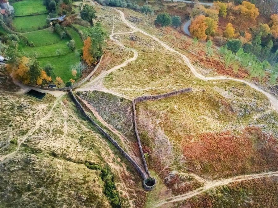
Mountain Biking & Cycling
Waymarked mountain bike routes in Caldas do Gerês and Terras de Bouro. Bike hire available in high season. Not allowed off the designated trails.
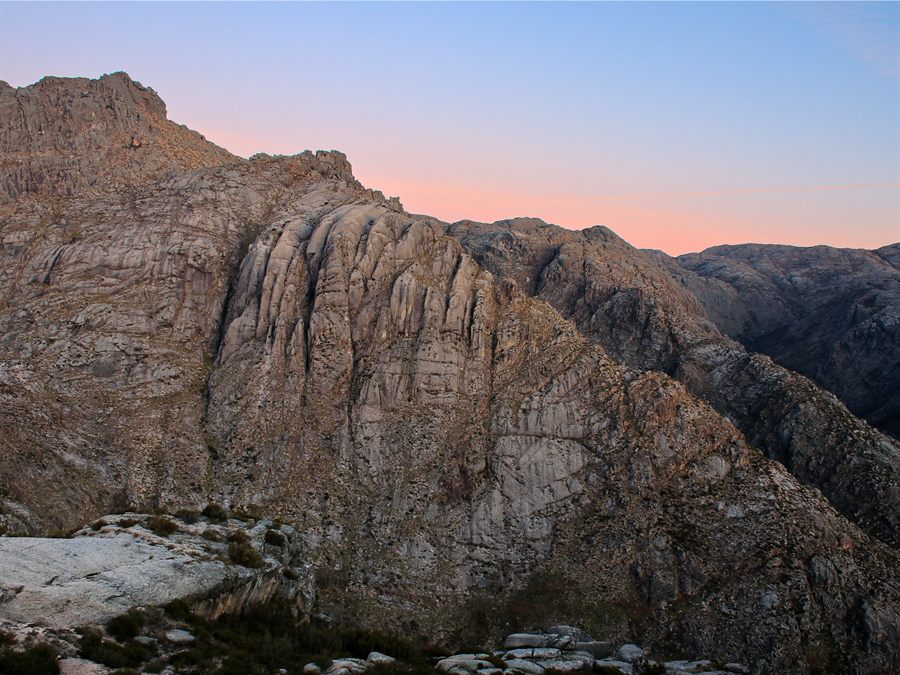
Climbing & Abseiling
The park's granite formations offer climbing routes for every level. Only allowed with an FCMP-certified mountain guide, in specific permitted areas.
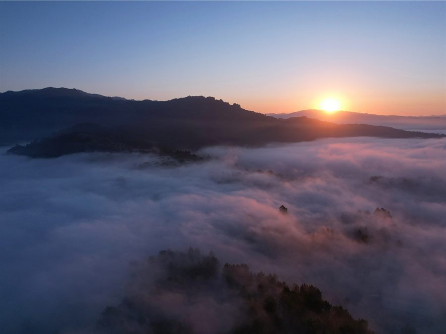
Nature Photography
One of Iberia's best destinations for landscape and wildlife photography: the Gerês lily (May–June), morning mists, garrano horses and granite. Commercial photography requires an ICNF licence.
Trail safety
Before you go — read this
Restricted trails: during periods of high wildfire risk (June–October), some trails may be closed by ICNF. Always check the status of the routes before setting off at icnf.pt ↗ or contact the local Visitor Centres.
Before you go
Download offline maps
AllTrails, Wikiloc or Maps.me with the routes downloaded. Mobile coverage is limited in remote areas.
Check the weather
IPMA for the local forecast. Mountain thunderstorms are common in summer — avoid exposed areas.
Tell someone
Leave your itinerary and expected return time with someone you trust or at your accommodation.
Basic gear
Water (2 L minimum), snacks, a first-aid kit, a waterproof layer, a power bank and proper footwear.
Conduct in the park
Stay on the trails
Leaving the trails damages vegetation, disturbs wildlife and increases the risk of fire and of getting lost.
Respect wildlife
Don't approach, feed or chase animals. Keep at least 30 m away from wild mammals.
Rivers & waterfalls
Always assess conditions before going in. After heavy rain, water levels rise quickly. Never jump without checking the depth.
In an emergency
Frequently asked questions
Questions about trails & activities
Straight answers to the most common questions about hiking routes and activities in Peneda-Gerês National Park.
The most popular trails are PR2 GER (Cascata do Arado, 8.2 km, Easy — ideal for families), PR1 GER (Rio Homem, 14.3 km, Moderate — the full landscape) and PR3 GER (Pedras Borrachas, 11 km, Moderate — unique views). For an epic multi-day traverse, the GR50 Peneda-Gerês Long-Distance Route crosses all 4 sectors of the park.